To make sure your calendar, event reminders, and other features are always
correct, please tell us your time zone (and other details) using the
drop-down menus below:
Set Date/Time format:
In 12 Hour format the hours will be displayed as 1 through 12 with “a.m.” and “p.m.”
displayed after the time (ex. 1:00p.m.). In 24 hour format the hours will be displayed as 00 through 23 (ex. 13:00).
You can always change your time zone by going to your Account Settings.
Use the dropdown menu to view the events in another time zone. The primary time zone will be displayed in parentheses.
Use the dropdown menu to view the events in another time zone. The primary time zone will be displayed in parentheses.
Visiting Robert Carr(username: robert)
Tag
Please wait...
Select a Color
Manage Applications
Check the items that you want displayed. Uncheck all to hide the section.
Calendars
Files
Addresses
To Dos
Discussions
Photos
Bookmarks
The “Switch Navigator” button will no longer be available after February 14, 2017.
Please learn more about how to use the new Navigator by clicking this link.
Geyserville From The Air
Geyserville From The Air
In August 2001 I had a chance to quickly fly over the Vineyard Club and Sonoma county in a small airplane. Here are some pictures I took.
The orange arrow points to our house by the Vineyard Club lake. You can see the island in the middle of the lake, and the clubhouse and beach to the right of the tennis courts.
Here is a shot looking almost straight down at our house. It's hard to see because it's nestled in and underneath giant live oak trees.
In this photo the orange arrow points to the club house.
Here's another shot looking back south at the lake, the arrow points to our house. In the background is the Russian river, Alexander Valley, and the town of Geyserville nestled against 101 and the foothils at top center.
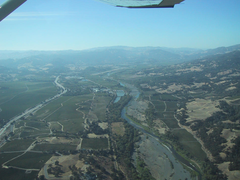
This view is looking north from the Alexander valley towards Cloverdale. On the right you can see the Russian River, note how narrow the water is in the summer compared to how wide the gravel river bed is from Winter flooding. On the left side is U.S. 101.
Lastly, here's a shot 40 miles west, on the coast, looking south at the Russian River meeting the Pacific Ocean at Jenner.
You can attach a link to this album to an event in your Calendar, a task in your To Do list or an Address. Check the boxes below for the data you want to
bring into the event’s or task’s description, and then click “Select text to copy” to have the next event or task you create or edit have the album text and link.
Click here to switch to Mobile Keep&Share, which works on any mobile device such as a smartphone or a tablet.
Touch the 'Full Site View' link at the bottom of any mobile view page to switch back to Full Site view again.
Get some help on how to use Keep&Share
Click to learn more about embedding Keep&Share in other websites.